|
Himawari 8
Automated Sciences is proud to announce Himawari Satellite Systems, a Weather Satellite Ground Station for the new Himawari 8 Weather Satellite.
The Himawari 8 Weather Satellite was recently launched by Japan and is operated by the Japanese Meteorological Agency. The data from the satellite is available without restriction or cost to any user capable of receiving it.
It is the first Weather Satellite that provides high resolution (1km/pixel) imagery covering the entire hemisphere every 10 minutes. In the past this coverage was effectively every half hour. Imagery this frequent makes a big difference in monitoring and providing short term predictions and warnings.
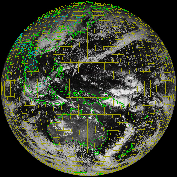
The image below shows the coverage area of Himawari 8.
|
|
|
A minimal system consists of the following provided components:
A satellite Receiver unit designed and tested to work with the Himawaricast satellite imagery dissemination service.
A C Band satellite LNB tested to work properly in this application.
Up to 60 meters of terminated RG-6 cable to carry the signal from the LNB to the Receiver.
A powerful small form computer for easy shipping with a quad core CPU, 16GB of high integrity ECC RAM, a 256GB SSD, gigabit ethernet, and an HDMI video output.
CentOS Operating System software with desktop and necessary servers enabled.
The software required to automatically ingest and store satellite data.
Our network centric SuperLooper Image processing and Animation software and the associated data server. The SuperLooper can be run on either the included computer or on just about any other computer system in your organization. Details on the SuperLooper and its capabilities can be found in the SuperLooper Brochure. Quick Browser View | Printable/High Res Download
|
|
The following items must be added to complete the system. These three items that should be available in most countries at a low cost (under $1000 USD) per item:
A 2.4 meter prime focus satellite dish. This is the same type of dish used by C Band and professional grade Ku band satellite television reception. In most cases a satellite TV dealer can provide this and assist in helping to get it setup and pointed at the satellite. If you have trouble locating this within your country we can either provide it (but shipping costs are high) or help you locate a distributor in a nearby country.
A Uninterruptible Power Supply to protect the equipment and allow operation during short power outages.
A quality LCD with LED backlight HDMI computer monitor.
|
|
The installation is quite simple except for dish pointing that we recommend you contract a local satellite television installer to assist you with.
The software usage is simple as much of it is automatic and the SuperLooper was initially designed 15 years ago to be used by high school students as part of a NASA educational program so selecting and loading desired imagery is a very simple process. We also provide a 40 minute video in English with the system covering the basics of satellite image interpretation.
This solution is ideal for any organization that has an interest in meteorological data. This includes government and private meteorological services, meteorological education at the university level, military operational interests, television stations, airports and related air safety organizations, marine and shipping interests, oil drilling and refining companies, and any other commercial operation that weather and storm passage may play a role in operations.
Personnel who use this system do not have to be meteorologists to interpret the imagery shown by this system. What can be learned from the included training video will provide enough information to effectively use this powerful tool and more advanced on-site training services are available contact us for details and pricing.
In addition to the supplied SuperLooper software this system can provide the real-time satellite imagery to our powerful RVT Workstation that includes the Rapid Visualization Tool software. Discounted pricing is currently available on this powerful Real-time meteorological visualization and analysis solution. Contact us for details and pricing.
|
